
Corpus Christi ZIP Code Coverage
Postal labels are useful geographic clues, but they are not neighborhood borders. USPS sources identify delivery and processing relationships, while the exact address still decides which service applies. The table keeps downtown, station, and unique assignments separate from broader delivery descriptions. It is a practical starting point for a Corpus Christi ZIP code directory search, not a claim that every address in a row lies inside the city line.
| ZIP | Areas covered | Post office or group | Notes |
|---|---|---|---|
| 78401 | Downtown and central Corpus Christi | Downtown Corpus Christi | Current processing group 78468 |
| 78402 | Downtown and central delivery grouping | Downtown group | Verify the delivery address |
| 78403 | Downtown postal and civic-core grouping | Downtown group | Delivery type needs address verification |
| 78404 | Six Points and central-south grouping | Six Points | Paired with 78463 in USPS material |
| 78405 | South and central grouping | 78465 processing group | Postal grouping, not a neighborhood line |
| 78406 | West and southwest grouping | Stonewall group | Grouped with 78409, 78410, 78426, and 78460 |
| 78407 | North-central and port-side grouping | Downtown group | Exact address check needed |
| 78408 | North and industrial port-side grouping | Downtown group | Current group 78468 |
| 78409 | Southwest and industrial grouping | Stonewall | Processing group 78409 |
| 78410 | Northwest and Calallen-area grouping | Stonewall | Station and processing relationship |
| 78411 | Lamar Park and central-east area | Lamar Park | Processing group 78427 |
| 78412 | Central and north-central grouping | 78468 processing group | Verify the individual delivery address |
| 78413 | Southside | Southside | Processing group 78427 |
| 78414 | Southside and Flour Bluff-side grouping | 78468 processing group | Postal relation only |
| 78415, 78416, 78417 | South and southwest groupings | 78465 processing group | Confirm each street through USPS |
| 78418 | Flour Bluff and island-side delivery | Flour Bluff | Grouped with 78480 |
| 78426 | Northwest and Calallen-related grouping | Stonewall group | Exact boundary not published in the inspected sources |
| 78427 | Lamar Park and Southside processing grouping | 78427 group | Processing relationship |
| 78460 | Southwest and industrial grouping | Stonewall group | Verify current delivery use |
| 78463 | Six Points and central-south grouping | Six Points | Paired with 78404 |
| 78465, 78467 | South and southwest processing grouping | 78465 group | Includes 78415 through 78418 in USPS grouping |
| 78466 | Central and north-central processing grouping | 78427 group | Grouped with 78411 through 78413 |
| 78468 | Downtown and central processing group | 78468 group | Includes several central service ZIPs |
| 78469 | H. P. Garcia and Nueces Bay Boulevard postal address | H. P. Garcia | Verify PO-box or institutional status |
| 78470, 78471, 78473-78477 | USPS destination or unique assignments | Assigned to Corpus Christi 78401 | Current delivery use requires verification |
| 78472, 78478 | Older or archived Corpus Christi groupings | Archived USPS material | Do not assume current residential use |
| 78480 | Island and Flour Bluff-side grouping | Flour Bluff group | Confirm the precise address |
USPS identifies 78470, 78471, and 78473 through 78477 as destination or unique assignments associated with 78401 in its 2019 list. That does not establish a universal street-delivery or neighborhood meaning. The Corpus Christi ZIP code directory should begin with the code on hand, then return to the address itself before treating a station relationship as a location fact.
Corpus Christi ZIP Station Groups
The station groupings give a more useful way to read a code than a broad city label. Downtown serves the 78401, 78402, 78403, 78407, and 78408 grouping. Six Points links 78404 and 78463. Stonewall links 78406, 78409, 78410, 78426, and 78460, while Flour Bluff links 78418 and 78480. Lamar Park and Southside are separate station clues for 78411 and 78413. These are postal processing relationships, not municipal planning boundaries.
Corpus Christi neighborhood names also come from planning and historic-preservation work. Downtown, Del Mar, Uptown, Ocean Drive, Lamar Park, Six Points, Westside, and other named areas are useful map clues, yet a planning area can differ from the postal label on an envelope. The city’s planning and GIS materials provide local context; USPS supplies the delivery check.
Note: A station or processing group helps narrow a search, but a specific street address remains the only safe way to verify service.
Verify a Corpus Christi ZIP
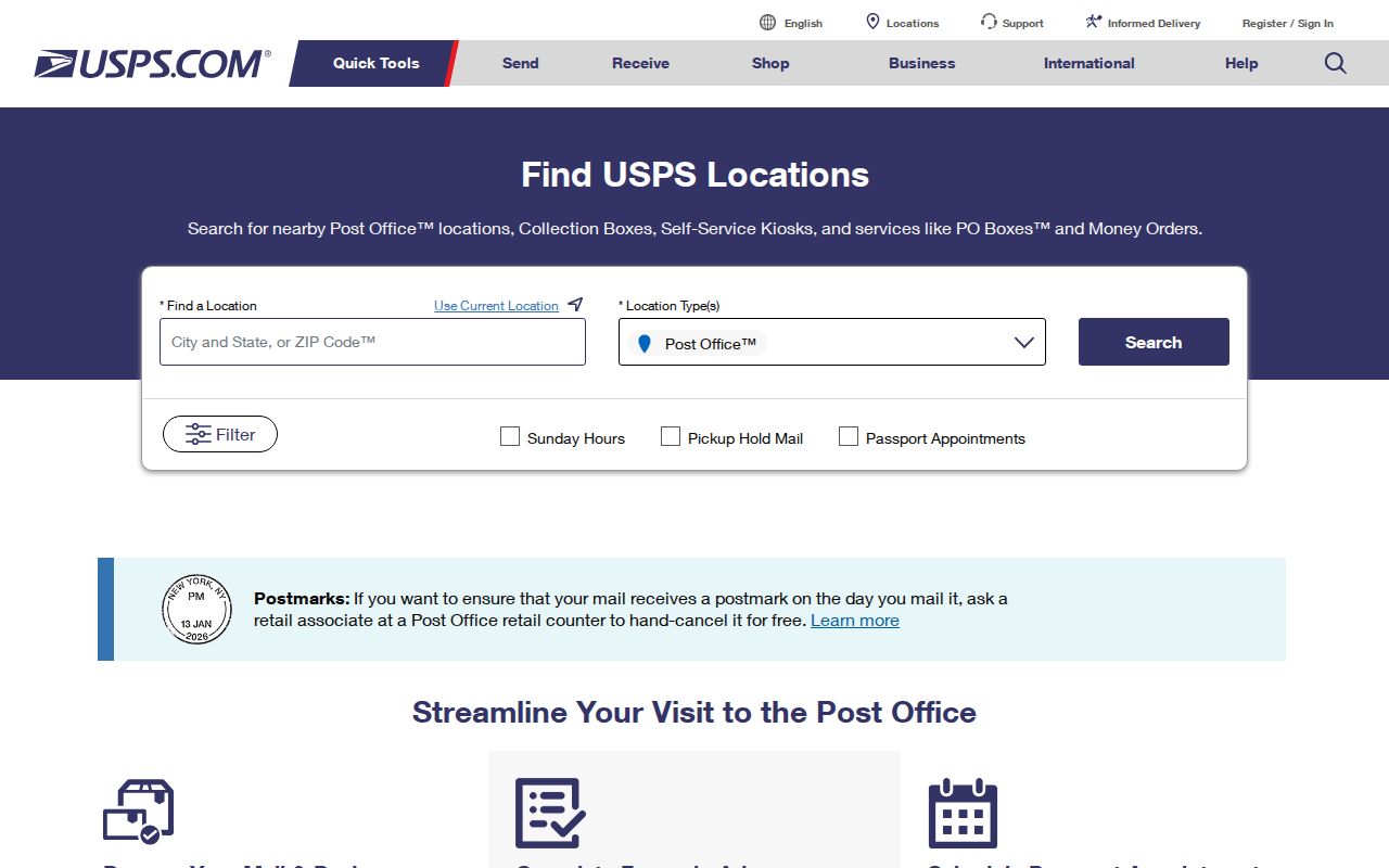
USPS Location Finder is the official first check when an address is incomplete or a code looks unusual. It accepts either a street address or a city or ZIP entry, plus a state selection. Its optional location filters help distinguish a Post Office, collection box, self-service kiosk, national retailer, contract postal unit, gopost, or Village Post Office. The tool verifies location and delivery context; it does not draw a legal city boundary.
| Finder field | How it is used |
|---|---|
| Street Address | Checks a specific delivery or location address. |
| City or ZIP | Accepts Corpus Christi or a five-digit query. |
| State | Sets the state context for a city search. |
| Location type | Limits results to the selected postal-service category. |
| Use Current Location | Uses device location when that option is appropriate. |
The USPS Location Finder screen shows the starting form used for this check.
Use the resulting ZIP with the street spelling and city, rather than relying on a station name printed on an older item of mail.
Search a Corpus Christi ZIP
A ZIP can narrow an address trail, but the local record systems do not all browse by postal code. My Voter Portal accepts ZIP as one matching input for a known person. Nueces CAD does not show ZIP as a standalone search field; it uses owner, street, property, geographic ID, tax year, and related fields. The city GIS is parcel and map keyed, and the Dynamic Portal is address and permit keyed. This is why a ZIP code directory search works best as a sequence, not as a roster request.
- Confirm the complete delivery address in USPS Location Finder.
- Use the street or owner information in Nueces CAD and preserve the situs address, mailing address, Property ID, and Geographic ID separately.
- Open the parcel in the Corpus Christi parcel and zoning dashboard to compare the map location with nearby boundaries.
- For a known voter, use the ZIP only with the state portal’s other matching information. It is not a public browse of everyone in a postal area.
- When the search narrows to one street, use the Corpus Christi street directory for the address-by-address record chain.
For a broader voter-file analysis, Texas uses a separate SOS public-information request with county, precinct, election, affidavit, deposit, and data-use conditions. It is not a simple ZIP-only download. A result from any one source should be labeled by its date and record type.
Corpus Christi ZIP Record Keys
Postal geography and land records use different keys. A situs is the physical parcel location. A mailing address is where notices go. A legal description identifies the recorded tract, often through a lot, block, subdivision, or metes-and-bounds description. The code on a tax mailing address can differ from the code at the parcel. That difference is common enough that it should be recorded, not silently resolved.
- ZIP+4
- The extra four digits route mail more precisely within a five-digit ZIP. They do not create a city or parcel boundary.
- PO-box ZIP
- A code that may route mail to boxes or a postal facility rather than identify a residential delivery area.
- Unique ZIP
- A destination or institution-specific assignment. USPS material must be checked before treating it as general street delivery.
- Carrier route
- A postal delivery grouping used to move mail. It is not a neighborhood, city-limit, or resident list.
Historical directories, deeds, and newspaper notices can use a former address format or no ZIP at all. When a modern street search fails, the legal description, plat, and year-specific address are better bridges than guessing a newer postal label.
Corpus Christi ZIPs and City Limits
USPS delivery geography, city limits, Nueces County jurisdiction, and Census geography are separate systems. A code can reach an unincorporated county area, a post-office box, an institution, or another delivery area. Conversely, a Corpus Christi parcel may need a city-map check even when its mailing label seems familiar. The inspected sources did not provide a definitive parcel-level city-limit and postal overlay, so an exact boundary cannot be inferred from the five digits alone.
Boundary check. Use USPS for delivery, the city GIS map for parcel geography, and the recorded legal description when an address crosses or approaches a jurisdiction line.
- Census ZCTA
- A generalized statistical representation of ZIP delivery geography, not a USPS legal boundary.
- Parcel boundary
- The mapped and recorded line for a tract, which does not move when a postal grouping changes.
- City limit
- The municipal boundary, which must be confirmed from city mapping rather than a mailing label.
The Census describes ZCTAs as broad representations of USPS delivery areas. They are useful for data work but do not establish whether a parcel is within Corpus Christi. A ZIP code directory is strongest when it keeps those three questions apart.
Corpus Christi ZIP Voter Match
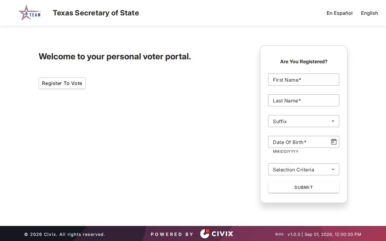
The Texas Secretary of State My Voter Portal is a known-person lookup. Its inspected inputs are first name, last name, county, date of birth, ZIP, and VUID. It can confirm voter information and a VUID when the match is available, but it is not a block or postal-area roster. Protected records can be suppressed, and the presence or absence of a voter match does not establish who lives at an address.
The My Voter Portal screen illustrates the matching inputs, including the ZIP field.
Texas Election Code protections and the Address Confidentiality Program can restrict display. Respect a suppression marker and use the authorized custodian process rather than trying to reconstruct a protected address from other records.
Corpus Christi ZIP Map Context
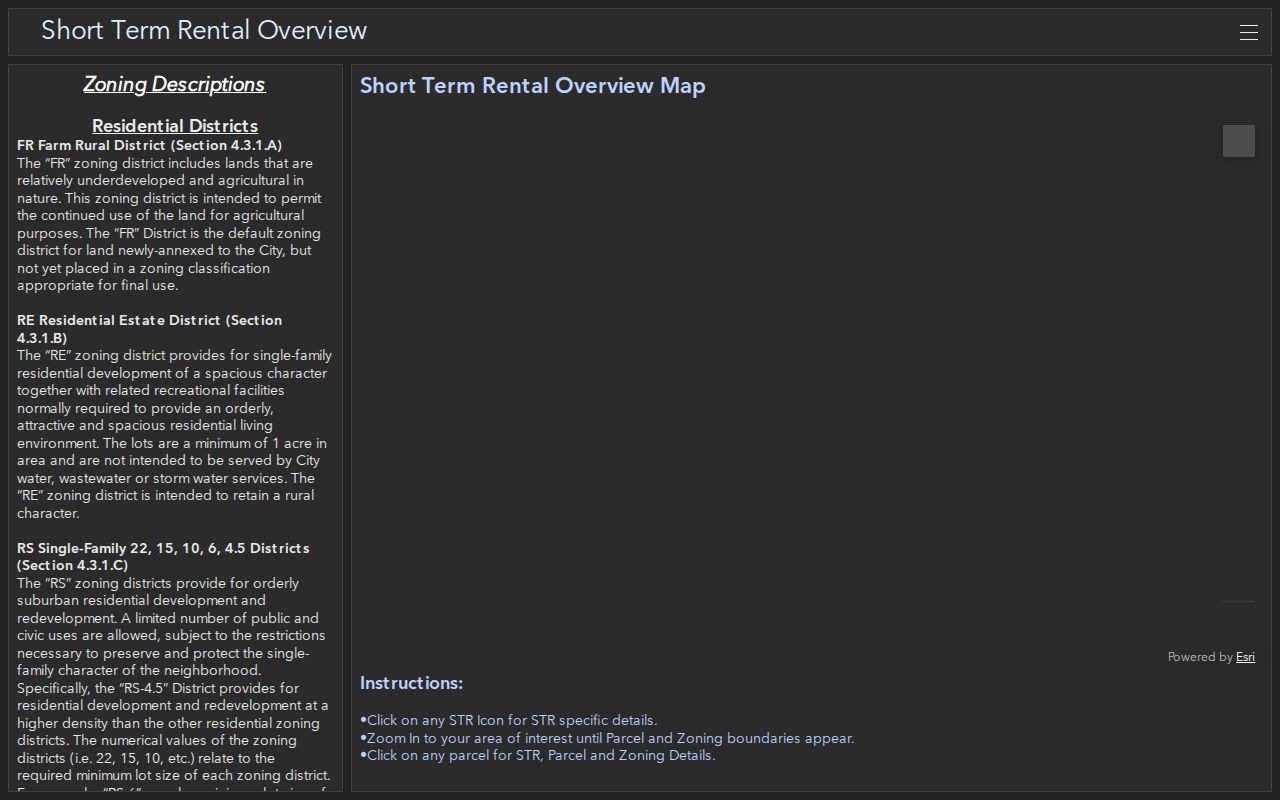
The Corpus Christi parcel and zoning dashboard adds the map context that postal tools lack. City GIS materials describe public layers for boundaries, utilities, gas services, public safety, parks, transportation, public services, and imagery. The dashboard can help compare a parcel with surrounding geography, but its live identify fields, buffer controls, and export behavior were not documented in the inspected text. Treat unconfirmed map controls as unavailable until verified.
The parcel and zoning dashboard is shown below as the geographic companion to the postal lookup.
Keep the map URL and search date with any result. Postal service groupings can change, and a plan area or parcel line says more about geography than a ZIP alone.
Note: No current Corpus Christi ZIP split or realignment year was located in the inspected official sources, so older and archived codes need fresh USPS verification.
Corpus Christi ZIP History
Postal information has a time stamp. The inspected USPS processing material is current to 2025, while the separate official destination and unique-assignment list is from 2019. Older USPS material also contains Corpus Christi groupings such as 78472 and 78478, but the research did not establish their current residential status. A code on an older directory, deed correspondence, or family letter is worth preserving exactly, then checking against USPS instead of translating it to a newer label by guesswork.
Historical local sources often rely on a street name, telephone exchange, subdivision, or legal description rather than a ZIP. Corpus Christi city directories have scattered runs from 1911 and 1913 through 1993, and Southwestern Bell volumes have a different 1909 through 1991 run with gaps. A postal code can help orient a later record, but it should not replace the year-specific address. When the address changed format, combine the directory year with a plat, parcel description, or map before connecting the two records.
The research found no verified year for a Corpus Christi postal split, realignment, or citywide address renumbering. That is a meaningful gap. It keeps the ZIP code directory focused on documented delivery relationships and sends unresolved historical boundary questions back to USPS, the county clerk, and city mapping.